
This solution leverages drone technology combined with AI to revolutionize surveying in sectors like mining, geology, and construction. The project solves the challenge of accurately estimating the volume of extracted materials (stockpiles) or excavations without dangerous and time-consuming manual surveys.
Technical Stack:
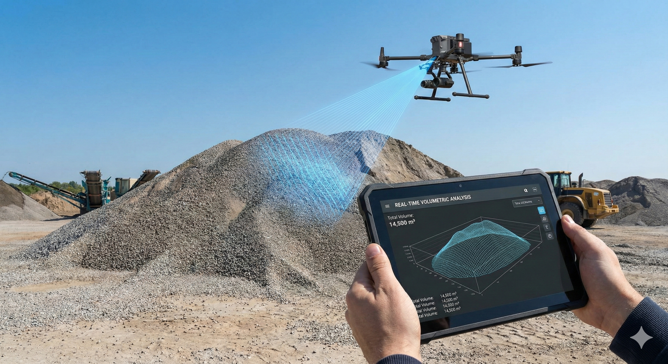
- Data Acquisition: High-resolution aerial imagery and LiDAR data from UAVs (Unmanned Aerial Vehicles).
- Processing: Photogrammetry software and Python-based 3D modeling libraries.
- Algorithms: Computer Vision for depth estimation and volumetric calculus algorithms.
Key Modules & Functionality:
- 3D Point Cloud Generation: Converts 2D drone images into precise 3D mesh models of the terrain.
- Automated Stockpile Estimation:
- The AI identifies distinct stockpiles (e.g., coal, gravel, soil) within the 3D model.
- Calculates the volume (V) based on the base area and height profile relative to the ground plane.
- Change Detection: Compares data from different dates to track progress, excavation rates, or material depletion over time.
Impact:
- Precision: Delivers volumetric measurements with up to 98-99% accuracy compared to traditional total station surveys.
- Safety: Eliminates the need for surveyors to physically climb unstable stockpiles or enter hazardous mining zones.
- Efficiency: Reduces surveying time from days to hours, providing stakeholders with rapid, actionable data.
Future Roadmap & Enhancements:
- Material Classification using Hyperspectral Imaging:
- Upgrading the computer vision pipeline to analyze spectral signatures. This would allow the system to not just calculate volume, but also identify the type of material (e.g., distinguishing between high-grade coal vs. waste rock) automatically.
- Predictive Stockpile Planning:
- Implementing time-series forecasting to predict when a stockpile will reach capacity or run out, helping site managers optimize logistics and truck schedules proactively.
- Autonomous Flight Paths:
- Utilizing Reinforcement Learning (RL) to enable drones to autonomously navigate complex mining environments, avoiding dynamic obstacles (like cranes or moving trucks) without human pilot intervention.
- AR (Augmented Reality) Visualization:
- Creating a mobile app feature where site engineers can point their tablet at a stockpile and see the calculated volume and 3D mesh overlaid in real-time on the camera feed.


